GeoSetter
3.5.3 Build 2195GeoSetter: A friendly image viewer that also lets you edit EXIF, IPTC and XMP data
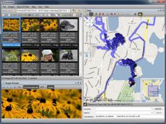
GeoSetter is a free application you can use to view all popular image files, as well as edit their geo data and other metadata, including EXIF, IPTC and XMP. The tool is incredibly feature rich offering a variety of functions like backups, maps, data synchronization, support for batch file renaming, advanced search and much more.Users can quickly open any folder and explore all the contained images, apply ratings, see thumbnails, but also organize the file using various factors like date taken, name, focal length, exposure time, file size and so on. At launch, GeoSetter will load a map automatically, and allow you to explore it but also make a list with your favorite places.
The program supports JPG, CRW, DNG, NEF, RAW, RWL, ARD, TIF, PEF and other widely used image formats, as well as several types of maps, including Google Street, OpenStreetMap, Satellite and Hybrid among others.
The program can follow the center of the map or the focused image and you can enable the display marker and crosshair, add directions and markers to your images, lock the direction angle of the focused image and zoom in and out.
To pinpoint images you can perform advanced search operations, plus you can configure logical rules for the file name and type, its description, location, camera and other criteria, with the possibility for all conditions or at least one to be met. For the same task you can even create several condition groups, but also create templates and reuse them in other projects.
Download Details
-
License:
Freeware
-
Platform:
Windows
- Publisher:
-
File size:
23.40 Mb
-
Updated:
Oct 31, 2019
-
User Rating:
0 / 5 (0 votes)
-
Editors' Review:
Not yet reviewed
-
Downloads:
1,747
Similar software
FotoBeschriften 6.8.1. Build 24.2.19
Will offer you labeling abilities for each photo according to its color, design and statement.
39 / 4,259
Hugin - Panorama Stitcher 2023.0.0
Intuitive cross platform panoramic imaging tool chain with foundation in Panorama Tools
63 / 5,682
QtiPlot 1.2.2
Create comprehensive graphs with this feature-rich data analysis and plotting application
31 / 2,965


